 |
 |
Historical Maps of Quiogue: 1835-2010
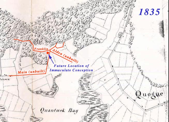
1835 Map of Quiogue with future location of the church and streets.
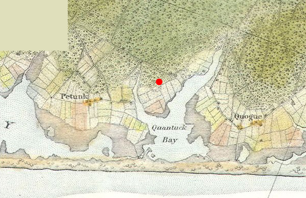
1856 U.S. Coast Guard map still showing Quiogue as open fields.
I like how Westhampton Beach is called "Petunk," Main Street has four buildings (probably houses),
and six corners only has two corners!
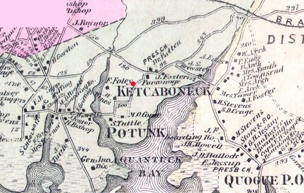
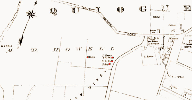
1873 map showing the newly built Turkey Bridge connecting Westhampton Beach with Quiogue.
Note that the Foley Farmhouse is still located on Aspatuck Creek. The first church was built [where the red dot is] in 1884.
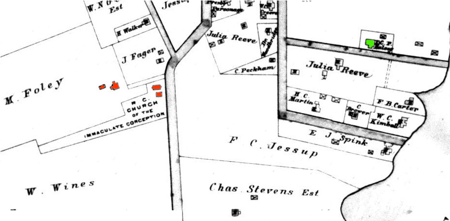
1896 map showing Foley home (after being moved) where the first masses were held from 1869 to 1885.
The present day parking lot for the Immaculate Conception was the original site of the Eager Farm. John Eager and his sister, Margaret came to this country from Ireland in the mid 1800s and purchased a large tract of land which compromised most of Quiogue. They cleared the land and set up a homestead, outbuildings and a small general store. Margaret married Francis Foley and settled on property to the west of John’s Farm on Aspatuck Creek. John Eager's store is visable above at current site of the church, and the former site of the original church building.
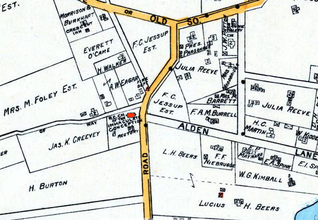
1902 Map of Quiogue.
Note the legal easments for Franklin Avenue and Ocame Avenue have appeared on the map.
The f irst Roman Catholic Church building is located at 8 Foster Lane (green structure above). This building located at the corner of Quantuck Lane and Foster Road was the first free-standing Catholic Sanctuary built on Quiogue. The building was originally built about 1884 on the site where the present Immaculate Conception is located today. The church had Sunday School rooms on each side of the central part, which was the sanctuary. After the new church building was built in 1891, for a short while this building became a store, then became the private residence of Stephen Foley. It was then moved to the north side of Meeting House Road on the property of the Foster Homestead. Here it became an annex to the Homestead called “The Oaks.” It handled the overflow of guests when the Homestead became full. Later, it was moved once more to its present location on the north side of Foster Lane by the Foster Family who also remodeled it.
1916 Map of Quiogue.
Note that Franklin is now a regular street and that Alden Lane has appeared.
This lane was opened about 1873. Named for Dr. Joseph Alden, principal of the Albany Normal School. In her 1914 work, “Chronicle of Quiogue,” Fannie Carter gives credit to Dr. Alden for shaping the Summer Colony along the shore. At the time of construction, most of the early summer homes in the Quiogue Colony were situated further off the water.
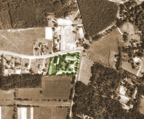
Aerial photograph taken in August 1938 by the U.S. Department of Agriculture.
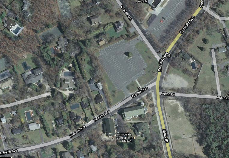
Quiogue in 2010.
This website is maintained by Prof. John Kneski, Miami, Florida & Westhampton, NY
Please direct all inquiries and/or submissions for the website to this email: kneskij@bellsouth.net